Sunday, April 22, 2012

Stop 4: The Himalayas

Hi guys! My flight here got delayed so I have to get started working on site right after I check into my hotel. There isn't even enough time for a nap! Talk about jet lagged... 
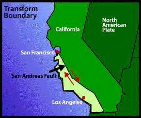
Even though I am really tired flying over the Himalayas made me super excited about what i was going to learn about them and the plate boundary. Here is a photo from the airplane that i took:
 
Did you know that the although the Himalayas is the highest mountain range in the world it is also the newest? I learned that from one of the plaques at the visitor center. 

I also discovered that the Himalayas are an example of a Collision boundary. A collision boundary is when there is a collision between two continents. The collision causes the crust at the boundary to be pushed up forming a mountain range. Mountain ranges are formed because neither of the two continents are dense enough to subduct. In this case the Indian subcontinent is now welded to the Eurasian continent because India is pushing northward into China at a rate of about 5 centimeters per year. 
Here is a picture to clarify:
 
As a result of the two plates colliding there are many earthquakes that occur. There were major earthquakes in 1950 and 1897. The most recent major earthquake was on September 18, 2011. Over 100,000 homes in India, Nepal and Tibet were hit. 

Well, on that not so uplifting note I have to sign off and run to the airport! Hope you enjoyed this blog! I will be back in Seattle to share this information with my club in a day or two!!

Longitude & Latitude: 30° 37N / 79° 48E

Thursday, April 19, 2012

Stop 3: San Andreas Fault, California

Hello blog people! I am now back in the Us. I'm here in San Andreas, California. It is good to be back in America, I don't have to worry about trying to understand some language when finding my way and learning!! This is a photo of me driving right by the fault!:
The San Andreas fault is an example of a Transform Boundary. A transform boundary is when two plates slide past each other. In this case the Pacific plate and the North American plate are the two sliding past each other creating the San Andreas Fault. The Pacific plate is moving NW  and the North American plate is moving Southeast.
I heard that sometimes the movement between these two plates can be as high as 5 centimeters per year. I also learned that some years the plates don't end up moving at all. Here is a photo from the San Andreas Fault Visitor & Information Center:
Image of a graph that displays the Transform Boundary.  Please have someone assist you with this.

                                 
As a result of the movement of the plates there are many earthquakes that hit the area. The most famous was in San Francisco in 1906. It destroyed the city and many people died. Earthquakes are continuing to be a regular occurrence in California.
I have a couple days to rest here before I take a looooong flight to the Himalayas, that will be my last stop! I hope you like this blog so far and find it interesting and informative!

Longitude & Latitude: 39° 0N / 123° 41W

Tuesday, April 3, 2012

Stop 2: Chile

Hi blog readers! I had a long flight that got delayed, but i finally made it to
Chile! This is the absolutely beautiful view from my campsite, i really recommend you stay here because its amazing and the people are so nice.
Anyways, now i will get started on telling you some of the stuff i came here for. I have been studying the subduction boundary between the Nazca plate and the South American plate. Subduction boundaries can either happen between two oceanic plates or an oceanic plate and a continental plate. This subdution boundary is between a continental plate and oceanic plate. At subduction boundaries a deep long trench forms called a deep-sea trench. These trenches form along with a chain of volcanic islands or mountains. A subduction boundary happens when two plates converge and the denser oceanic plate subducts, or sinks beneath the less-dense continental plate. This is when the deep-sea trench forms and a mountain chain and volcanoes form inland on the overriding continental plate. That why there is also a lot of volcanic activity here in Chile. This is exactly how a subduction boundary works: 
I don't know if you remember this, but on Saturday February 27, 2010 at 6:34 local time a huge earthquake happened here in Chile. It had a magnitude of 8.8 on the scale and triggered a tsunami that wiped out a large port. 
Also, Chile is the home of one of the largest mountain chains in the world, the Andes. This mountain range is caused by the convergent boundary of the Nazca and South American plate and runs all the way down the border of Chile. There are also four main active volcanic zones in the Andes mountains, separated by sets of inactive volcanoes. 

I am signing off from Chile , to get back on schedule and meet my 80 day deadline I got to  get on a plane quick and make it to the Himalayas in Asia. My flight leaves early tomorrow morning so I should get some sleep! Bye bye for now!

Longitude & Latitude: 35° 40S / 71° 32W

Stop 1: East Africa Rift Valley

Hey blog readers! I am now in Africa, wow its really hot here compared to back home. I am here at the east Africa rift valley at the sight of a divergent boundary. This rift valley runs from Northern Syria to central Mozambique in south eastern Africa. Wow. Isn't that huge!! This is exactly where I am: 

I've learned divergent boundary is between two lithospheric plates that are moving apart. When these plates move apart they create a rift valley that runs along the entire mid-ocean ridge. When the plates move apart, they obviously will leave a gap. But, how does that gap get filled? Well the answer is that when plates move apart magma from the inner layers of the earth go up through the gap and cool, creating new rock to fill the gap. This happens because magma or lava is just liquid rock so when it cools and becomes a solid it is a new hard rock! Here is a picture diagram of what that looks like:

Here in Africa this is really pretty and the view of this divergent boundary is really epic. When you get the chance, or you happen to be in Africa you should for sure check it out. It is cool and you get to learn some science while your at it! Our next stop is south america, wish me a safe flight!!

Longitude & Latitude: 4° 48S / 29° 47E

Monday, April 2, 2012

Welcome- Introduction

Hi guys, I'm Chloe! This is going to be my blog about my experience traveling the world for credit to graduate with a major in tectonic plates from the University of Washington. Through this blog you will hear about my experiences at different tectonic boundaries around the world. This trip is funded by my tectonic plate club and I will be reporting about this experience to my other club members through this blog. I will be visiting places close to the Pacific Northwest like California along with Asia, South America and Africa. My tour will last about 80 days, I hope you like it!


Disclaimer: This blog is totally fictional, I am not affiliated with the University of Washington in any way. This blog is just for a project in my science class.